
Environmental risk screening uses satellite imagery, spatial data, and geospatial interpretation to assess site context, surrounding land use, visible disturbance, and other observable indicators relevant to environmental review. It is useful for early-stage screening, targeted diligence, and structured review where field access is limited or phased.
Environmental Risk Screening
Multi-Index Satellite Detection of Mine Expansion
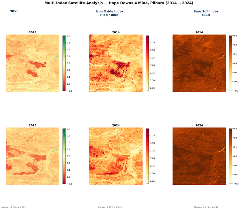
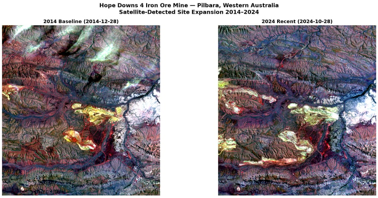
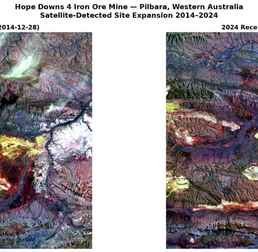
A 10-year analysis of Hope Downs 4 in Western Australia using NDVI, Iron Oxide Index, and Bare Soil Index to identify and cross-validate mining-related land transformation.
The Challenge
Remote industrial sites are difficult to verify through disclosures or occasional site visits alone. In arid environments, single indicators can also be ambiguous, making it harder to separate operational expansion from drought, erosion, or seasonal variation.
Our Approach
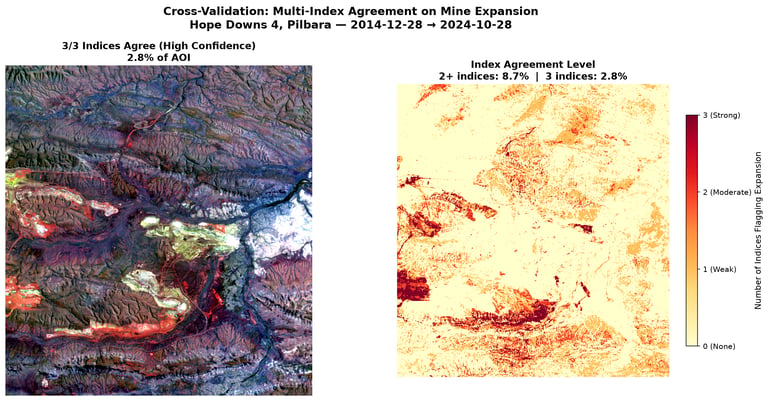
The analysis compared two time periods using Landsat imagery and three independent spectral indicators: NDVI, Iron Oxide Index, and Bare Soil Index. Agreement across these indices was used as a confidence framework for identifying mining-related expansion.
Why This Matters
This type of workflow can support due diligence, remote asset monitoring, supply-chain verification, and ESG review by providing a more defensible view of land-use change at industrial sites.
Key Findings
All three indices supported the conclusion of expansion between 2014 and 2024.
Vegetation declined while bare-ground and iron-oxide signals increased.
The strongest agreement was concentrated around active mining areas.
Cross-validation reduced ambiguity from environmental background noise.
Need an independent view of industrial site expansion or land-use change?
We support screening and verification workflows using satellite-based analysis across mining, infrastructure, and supply-chain contexts.
Intro
We used a three-index satellite workflow to examine land-use change around the Hope Downs 4 iron ore operation in Pilbara, Western Australia, between 2014 and 2024. By combining vegetation loss, ore exposure, and bare-ground signals, the analysis produced a stronger expansion assessment than a single-index approach alone.
If the situation is complex, sensitive, or difficult to move forward with confidence, we would be glad to explore whether an initial conversation would be useful.
Discuss a project
LU FRONTIER STRATEGIES
© 2026 LU Frontier Strategies. All rights reserved.